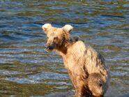
Brooks Lodge's June 19, 2019 09:15 AKDT Facebook Post with Kara Stenberg's Photo of Subadult Passing Through Camp:[]
Brooks Lodge's June 19, 2019 at 09:15 AKDT Facebook post with Kara Stenberg's photo of a subadult passing through camp.:
Mike Fitz', Resident Naturalist with Explore.og, June 19, 2019 12:31 AKDT Comment:[]
On June 19, 2019 at 12:31 AKDT, Mike Fitz, Resident Naturalist with Explore.org commented :
"Good afternoon from Brooks River. Work to install and fine tune the bearcams continues at a rapid rate. Technicians are working currently on installing cameras on the bridge at the mouth of Brooks River. Bears and salmon continue to move through the area in low numbers. Two nights ago at the falls, I counted 5-15 salmon jumping per minute when a small pulse of fish moved through. If any of the bears who fish the jacuzzi had shown up at that time, then they would probably have been able to make a few catches.
While you are waiting for the cams to go live, I invite you to read my latest blog post for explore.org (To Novarupta: Exploring the Valley of Ten Thousand Smokes) . Instead of exploring the world of bears and salmon in it, I explore a bit of my trip into the Valley of Ten Thousand Smokes , a unique landscape on Earth and the place that catalyzed the effort to formally protect Katmai in the late 1910s. If you have questions about the Valley of Ten Thousand Smokes, my trip there, or the activity at Brooks River, then please reply to this comment and I'll do my best to answer.":
Blog: To Novarupta: Exploring the Valley of Ten Thousand Smokes by Mike Fitz for Explore.org
"I could see the dust clouds forming ahead under a stiffening south wind. Luckily, some of the landscape was still snow covered or at least damp with snowmelt, tempering the wind’s ability to carry fine dust into my lungs and eyes. Still, the experience wasn’t what I would describe as pleasant. Volcanic ash is sharp, abrasive, and irritating. Pausing my progress, I turned to face away from the strongest gusts, using my pack and hat as a partial shield against the wind. I stood in the middle of the most barren region of the Valley of Ten Thousand Smokes in Katmai National Park where blowing ash would eventually erase my tracks just as readily as they would disappear in melting snow.
While Katmai National Park in Alaska is most famous for brown bears, the area’s volcanic backbone was the catalyst for the park’s protection. On June 6, 1912, at the head of an isolated valley on the northern Alaska Peninsula, Novarupta Volcano erupted on a scale rarely equaled in recorded history. The eruption spiraled ash 100,000 feet high (30 km) in the atmosphere. It plunged Kodiak, over 100 miles from the eruptive center, into complete darkness during a season when the town would normally experience 20 hours of daylight. The eruption forced Alaska Natives to flee Katmai and Savonoski villages. They arrived at safe locations only after long, arduous paddles while ash and pumice fell around them. The eruption lasted nearly three days, enveloping hundreds of square miles in volcanic fallout. When it was over, the approximately 7,600-foot summit of Mount Katmai had collapsed, leaving a sharply rimmed, 2,000-foot deep caldera and a valley transformed into an otherworldly landscape. It was the fifth largest eruption in the last 1000 years and the 20th century’s largest.
Today, the Valley of Ten Thousand Smokes and the volcanoes of the Katmai cluster remain a place of great scientific and scenic interest as well as a challenging place to visit. I came expecting ash and strong winds, having spent about a collective month camping in the “Valley” over the last 12 years. This afternoon, as I stood almost dead center within it, brought both. Yet, exploring this place never gets old. How could it when it has proven Earth’s ability to change in an instant?
Like most people, I began my journey into the Valley by booking a ride on the daily bus tour from Brooks Camp, the hub of visitor activity and bear viewing in the park. After reaching the drop off point, I followed a seldom-maintained trail through thick willows to Windy Creek and a short, but chilly ford. Across the creek, I began to hike on vast pumice-covered flats. During the next five days, I would be walking almost exclusively on this surface.
The Valley of Ten Thousand Smokes is the product of massive and repeated pyroclastic flows that originated during the 1912 eruption. Think of a pyroclastic flow as a volcanic avalanche, an unconsolidated mass of ash and rock collapsing from an eruption column. They are one of the most dangerous and destructive of all volcanic hazards. Pyroclastic flows buried Pompeii during the 79 A.D. eruption of Mount Vesuvius. A similar phenomenon, a pyroclastic surge, killed 28,000 people during the 1902 eruption of Mount Pelée on Martinique in the Caribbean.
The 1912 eruption’s pyroclastic flows eventually covered about 45 square miles of land. In total, Novarupta unleashed roughly four cubic miles of ash and 2.6 cubic miles of pyroclastic flows. This represents three cubic miles of underground magma, an output slightly greater than Krakatoa’s 1883 eruption and thirty times more than Mount Saint Helens in 1980. My first day into the Valley on this trip was June 8. If I had been there on the same day in June 1912, the eruption would have still been ongoing and I would not have survived.
For decades after the eruption, the land steamed with thousands of fumaroles, the sight of which led Robert Griggs, the botanist who led the first exploratory expeditions into the area, to christen the area the Valley of Ten Thousand Smokes. It was this place that inspired him to lobby for formal protection of the area, an effort that succeeded when Katmai National Monument was established in 1918.
Griggs first came to Alaska to study vegetative recovery in the wake of the eruption, but soon turned his attention to exploring the eruptive center, discovering the Valley during a long, laborious expedition from Katmai Bay on the Pacific coast in 1916. He returned for several more trips to explore the landscape, which was and remains unique on the face of the Earth. This is the only historic eruption to have emplaced large-scale pyroclastic flows on land. The impacts became a wonder to Griggs and remain so for wanderers like myself and modern-day volcanologists.
In the late 1910s, 86 fumaroles had temperatures over 190˚ C (374˚ F). The hottest was measured at an incredible 432˚ C (809˚ F). In his classic 1922 book, The Valley of Ten Thousand Smokes, Griggs writes that travel across the Valley was initially worrisome. Griggs was, obviously, unaccustomed to walking on a potentially scalding surface and feared falling through to be cooked alive. His team gained experience and confidence as they went, however, finding the surface supported their weight easily, even as they could create new fumaroles by poking their hiking staffs into the ash. Trepidation quickly gave way to the practicalities of exploring the landscape. With no vegetation to build fires, Griggs and his team used the fumaroles to cook their food and to melt snow for drinking water .
Over time, the ash sheet cooled, but the legacy of the fumaroles is preserved in the ash. The surface of the Valley is stained with ochers of red, yellow, pink, brown, and cream, marking where scalding steam cooked the rock as it escaped to the surface. To me, these are some of the Valley’s most interesting and beautiful features, kaleidoscopes of color in an otherwise brown and gray landscape.
About 11 miles from the beginning of my hike, I rounded the shoulder of Baked Mountain and began the final approach to Novarupta, the still-steaming lava dome that marks the vent of the 1912 eruption. I often prefer to camp in this area because I can find nooks that are reasonably sheltered from the wind as well as snowmelt for drinking water. It’s also the most colorful part of the Valley, where particularly intense fumarolic activity colored the surface with earth-toned rainbows.
Novarupta was the last gasp of the eruption. Its lava was largely degassed by the time it began to ooze to the surface over the days or weeks immediately after the eruption. A ring of coarse pumice surrounds the dome and some of it remains noticeably hot. The ground is safe to walk over, unlike the geyser basins of Yellowstone, but a carelessly placed hand or chosen seat will result in a painful surprise.
The area is far from sterile though. Thick mats of beautiful, pristine biological soil crusts grow in the basin surrounding the Novarupta. Caribou and brown bears use the area. Plants have established a foothold here too. Novarupta lies just below 3,000 feet in elevation, which in Katmai is well above tree line, so plant cover was never great here to begin with. In sheltered pockets surrounding Novarupta though, where steam warms the ground and soil crusts help to hold the ash and pumice in place, tundra plants like partridge-foot, clubmoss mountain heather, and Katmchatka rhododendron were just beginning to bloom. Insects, even a few mosquitoes, were abundant. The blocky structure of the 200-foot high lava dome also provides habitat for many snow buntings. I listened to the males serenading for females as I pitched my tent and went to sleep.
I stayed in the Valley for four nights total, using the many hours of late spring daylight to ramble to pockets of the landscape I hadn’t explored previously. Each time I experience this place, it is different, and that’s what makes it particularly intriguing.
The 1912 eruption won’t be the last in Katmai. Indeed, it isn’t even the most recent. Trident Volcano, whose summits tower above the upper Valley, erupted periodically from the mid 1950s to early 1970s. Many other large volcanoes and lava domes are found within a few miles. The Valley of Ten Thousand Smokes remains raw, a place still recovering from the effects of the 20th century’s largest volcanic eruption. Here though, walking through a unique landscape, Earth’s potential for sudden change is on full display."
On June 19, 2019 at 13:39 LuvBears asked: "I'm always amazed at the back country campers. You've mentioned previously about making that trek solo. Did you venture out alone this time as well? Do you carry a satellite phone so you have a way to contact someone ICE? When setting up your campsite, do you surround it with any type of fence/deterrent? Did you see any bears in the VTTS? Have you discovered any other finds left behind from previous expeditions? What other birds are seen in the VTTS, any eagles? Thanks for sharing your trip and bear-ing with my curiosity. So nice to have you there."
On June 20, 2019 at 08:41 Mike Fitz replied : "
I almost always hike alone, and I was alone on this trip too. This, of course, increases risk and my margin of error is much smaller than a group of people, but for me it is an acceptable risk and I often moderate what I do so that I don't undertake unnecessary risks. While I have utilized SPOT devices and satellite phones in the past, I didn't on this trip.
Bears use the VTTS and while I saw many fresh tracks, I didn't see any bears. The VTTS has little to offer bears in the way of food, so their densities are much lower there compared to other areas of the park. However, I still make an effort to camp away from places where bears are likely to travel in the Valley.
In 2013, while exploring the upper VTTS near Mt. Cerberus, I found a campsite that Griggs used during his 1919 National Geographic expedition. I was surprised by the find, but intrigued by the window into the past the artifacts revealed. I found the ends of burnt tent stakes, pieces of leather, glass, and a shovel. Since then, the park's archeological team has inventoried the site, which is one of the first steps to document and protect it.
Photos of a shovel and tent stake from the campsite:
Eagles probably use the area as migration corridor, and I have seen on golden eagle there, but they are not common in that area of the park. In the upper VTTS, rock sandpipers, American pipits, snow buntings, and a few semi-palmated plovers are the most commonly seen birds at this time of year."
On June 19, 2019 at 13:34, Kasia asked: "Can you still cook over the fumaroles? I gather you've burned your butt, but have you tried cooking? And - while we wait for the cams - you might elaborate on the differences in the equipment between you and Griggs - I remember you mentioned his iron-cast skillets in a chat long, long ago - how about the food? What did they take and eat as opposed to you in 2019?"
On June 20, 2019 at 12:48, Mike Fitz replied : "I have not burned my butt, but I have talked to people who have. The hot spots around Novarupta are relatively small and only lightly steaming at the surface so you can't cook on them anymore. Griggs took items like cast-iron skillets and Dutch ovens to cook food such as bacon, beans, and pancakes. I usually don't bring a stove or pot on these trips, opting to eat foods that are already cooked or don't need to be cooked. A hot meal is nice, certainly, but I can live without them for a few days when I am hiking. Griggs spent weeks in the VTTS and couldn't keep his cheese refrigerated at Brooks Camp like I can, so in many ways cooking was his best option. If you haven't seen it before, this video shows a bit about what life was like for the National Geographic expeditions into the VTTS."
On June 20, 2019 at 09:41 AKDT, Kasia again commented to Mike: "Yes, I've seen it, thus my question about the cooking :-) That film is still absolutely fascinating and I just re-watched it with great pleasure again :-) Did you notice how they flipped a pancake on the (iron-cast) skillet on this long stick??? And I love the captions: "What chance has a snowball in Hell?" :-))) And who is the lady? Griggs' wife, right? OMG, she's wearing a long skirt while hiking amongst all those fumaroles and she flips pancakes just like that... What a cool lady! (Maybe, during the winter hibernation, you could write a post about her? Was she the one nicknamed Dumpling, which gave the name to DM?)"
On June 20, 2019 at 10:59, Mike Fitz replied to Kasia: "The origin of the name Dumpling Mountain is unknown. There is a rumor it was a nickname of someone, but I have seen no proof of that. The only thing I know for sure is that it was named by Griggs in 1919 ."
On June 19, 2019 at 13:31 AKDT, ColoMountainGirl (CMG) asked: "Thank you Mike for taking the time to write about the Valley. I have to wonder if Mt. Katmai and Novarupta share the same mantel conduit system. The reasoning behind this is the collapse of Mt. Katmai in forming it's caldera happened during the eruption phase of Novarupta. Many times a caldera is formed when for one reason or another a magma reservoir that is supporting the material above it is drained out causing the material to collapse in on itself like what we just witnessed happening last year with Kīlauea's Halemaʻumaʻu and Puʻu ʻŌʻō Craters being drained into the east rift zone. Do you happen to know if the USGS volcanologist believe that the mantel conduit is shared between Mt. Katmai and Novarupta? I'm also wondering if sulfur deposits exist around areas venting? Thanking you in advance."
On June 20, 2019 at 09:20 AKDT, Mike Fitz replied : "There is some sulfur in the VTTS, but not much that I've seen. The best examples I've found are high on the slopes of Mount Griggs where large hot fumaroles exist (these are unconnected to those that existed in the VTTS).
One of the most intriguing aspects of the 1912 eruption is that three different types of lava erupted--andesite, dacite, and rhyolite. Some of the pyroclastic flows and fallout are highly rhyolitic and some are highly andesitic/dacitic, but there was frequent mixing. In fact, banded pumice containing chemically distinct lavas can be found in the VTTS. This indicates the lavas mixed during and just prior to the eruption."
So what does this have to do with Mount Katmai? You are correct to surmise that the collapse of Mount Katmai was connected to the eruption at Novarupta. However, the connection between the two is thought to be much shallower than Earth's mantle. It is perhaps just three or four kilometers below the surface.
The prevailing hypothesis is that there was one large, zoned magma chamber under Mount Katmai composed of rhyolite, dacite, and andesite. The magma then somehow traveled through a horizontal sill to vent at Novarupta. When the vent at Novarupta opened, it drained the magma chamber underneath Mount Katmai, leading to caldera formation.
The dynamic between the magmas and the venting mechanisms are one reason why the 1912 eruption is so interesting to volcanologists. There really is no other historical eruption that produced the same "products" in the same way. If you want to read more, please check out page 211-219 in The Novarupta-Katmai Eruption of 1912—Largest Eruption of the Twentieth Century: Centennial Perspectives . The whole book is an amazing synopsis of the eruption."
On June 19, 2019 at 13:17 AKDT, Kasia asked: "Super wonderful! Thank you Mike for taking us on this adventure :-) You write like a devil, man! I've read many blog-posts about trips to the VTTS, and I've always wondered who gave the river Lethe its (quite appropriate) name?"
On June 20, 2019 at 09:21 AKDT, Mike Fitz replied : "River Lethe was named by Robert Griggs during his National Geographic Society expeditions. At one time, his team measured the river's temperature at well over 100˚F."
On June 19, 2019 at 13:13 AKDT, GrandmaJ asked: "As you approach the area of the volcano, is there a strong smell of sulfur?" On June 20, 2019 at 09:22 AKDT, Mike Fitz replied : "There is a hint of sulfur in the air, but it is not strong. I found it to be much stronger in an airplane while flying over the Valley, especially when you get close to the bubbling caldrons on Mount Mageik and Mount Martin."
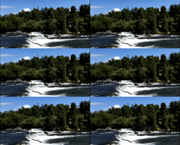
LOOK, IT'S MIKE FITZ, RESIDENT NATURALIST WITH EXPLORE.ORG TESTING THE LIVE CHAT/PLAY-BY-PLAY EQUIPMENT FROM BROOKS FALLS, with A SPECIAL GUEST APPEARANCE BY 634 POPEYE & ANOTHER BEAR, JUNE 19, 2019 14:09 AKDT:[]
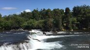
Mike Fitz, Resident Naturalist with Explore.org goes live to test the live chat / play-by-play equipment from Brooks Falls, June 19, 2019 at approximately 14:09 :
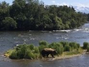
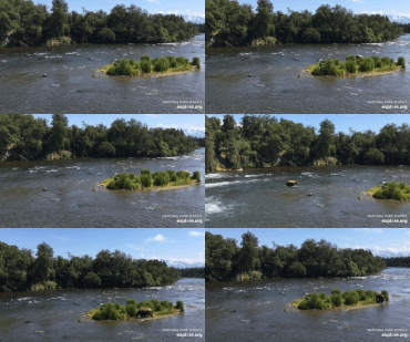
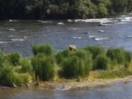
At approximately 14:18, KCanada shared the 1st live cam bear snapshot of the 2019 season, 634 Popeye. At approximately 14:19, Erie shared her first snapshot of the 2019 season, also of 634 Popeye. At approximately 14:23, KCanada shared more of her snapshots (#1 , #2 & #3 ) of 634 Popeye. At approximately 14:28, Xander-Sage shared a gif she created. At 14:33, Goldilocks shared a snapshot of Mike Fitz from when her first went live and the falls appeared backwards. At 14:37, Courtney (Explore) shared her snapshot of 634 Popeye headed for the island. Martina shared her gif at 14:37. At 14:40, Kam shared the 1st bear butt snapshot of the 2019 season, 634 Popeye. At 14.43, Kam shared more of her snapshots (#1 634 Popeye , #2 the other bear , & #3 634 Popeye ). At 14:43, Xander-Sage shared their gif of the other bear & 634 Popeye. At 14:45, Bearz61 shared snapshots (#1 & #2 ) of the other bear. At 14:48, Xander-Sage shared this snapshot of the other bear. At 14:51, Scooch shared their gif of 634 Popeye. Scooch shared their gif of the other bear at 14:55. Cruiser shared this gif of Mike Fitz and 634 Popeye.:
Mckate created this video of part of Mike's test, without sound. "Our first cam bears of the 2019 season are an unknown blond sub and 634 Popeye on the island.":
Lani H created this video of Mike Fitz testing the live chat equipment.:
Bears Observed at Brooks Falls on the Evening of June 19, 2019, Katmai Conservancy Ranger Naomi's June 20, 2019 08:55 Comment:[]
On June 20, 2019 at 08:55 AKDT, Katmai Conservancy Ranger Naomi commented and shared photos (#1 634 Popeye , #2 128 Grazer , #3 128 Grazer on the lip , #4 856 ) of the bears observed at Brooks Falls on the evening of June 19, 2019.:
"The salmon have arrived and the bears have followed. Last night Mike Fitz, John Koster and I were at The Falls. Here are pictures of 634 Popeye, Grazer (sorry, no cubs), a sub and 856. When 856 strutted in, Grazer had already left having eaten 7 salmon. But Popeye took one look at 856 and ran up the far bank. 856 not satisfied with that, followed him up the bank. Dominance seems to be his priority. Once satisfied that Popeye was really gone, he returned to take his place in the jacuzzi. The season has begun."
128 Grazer at Brooks Falls on the Evening of June 19, 2019 Photos by Kara Stenberg from Brooks Lodge's June 20, 2019 15:57 AKDT Facebook Post:[]
On June 20, 2019 at 15:57 AKDT, Brooks Lodge's Facebook post with Kara Stenberg's evening of June 19, 2019 photos (#1 , #2 , #3 & #4 ) of 128 Grazer successfully fishing the lip of Brooks Falls.:
128 Grazer and A Subadult Video by Kara Stenberg, June 19, 2019 21:30 AKDT:[]
Sow 128 didn't take kindly to a subadult (likely one of her own cubs she emancipated last year) being nearby so she chased it up into a tree. The video shows her standing by as the sub-adult climbs out of the tree; video by Kara Stenberg:


